


Innovation Series: Technology Is Helping to Ensure Polio Workers Are Where They Are Most Needed
"The polio eradication programme is using technology in innovative ways to map the activities of polio workers on the ground, and ensure that expertise and support is getting to the areas where it is most needed."
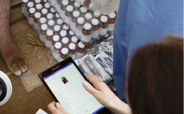
According to this report, international consultants deployed by partners of the Global Polio Eradication Initiative (GPEI) are using a new information and communication technology (ICT) tool, Survey123 for ArcGIS, in some of the countries most vulnerable to polio. Available for smartphones, tablets, and desktops, the mobile application (app) is designed to replace unreliable paper-based data collection with a digital solution that fits the needs of field personnel in diverse environments. It is described on the Survey123 for ArcGIS website as "a simple and intuitive form-centric data gathering solution that makes creating, sharing, and analyzing surveys possible..." Users can "[d]esign Surveys that speed the collection process with predefined questions that use logic and provide easy-to-fill answers, embedded audio and images, and offer multiple languages. Data captured in Survey123 for ArcGIS is immediately available to the ArcGIS Platform: Use maps to visualize, analyze and share your field work."
The GPEI explains that more than 300 international consultants are using Survey123 to strengthen surveillance, track the wild poliovirus (WPV), identify immunity gaps, and support vaccination campaigns to fill them. The introduction of this new technology means that each week, no matter where they are in the world, the consultants report on their activities. The report only takes a minute to complete, works offline, and captures their location at the time of reporting. By answering questions on what activities and diseases they have been working on that week, this tool enables the GPEI to capture data in real time and to ensure that the consultants are being efficiently deployed in high-risk polio areas. "These innovations ensure that countries receive the best support from these consultants, and that they are working where the need is greatest."
Survey123 is also enabling the GPEI to identify changes in deployment over time. The recent notification of WPV in the Lake Chad region demonstrated the use of this clarity by showing the movement of consultants into and around Africa's Lake Chad region, despite insecurity and inaccessibility. In-depth analysis such as this provides greater clarity on what additional human resources are needed to respond to outbreaks or newly recognised risk areas, and indicates how rapidly GPEI resources can be used to fill needs.
Furthermore, analysing the collected reports from Survey 123 is giving GPEI greater insight into the extent to which consultants are supporting other health programmes, including improving routine immunisation, measles activities, communication for development, and emergency response. The GPEI explains that, due to the scale of polio eradication activities even in the most remote and vulnerable areas to reach every last child, international consultants are sometimes present where other health infrastructure is weak. "The information gathered from this new technology is helping to inform transition planning efforts, providing information needed to country governments and GPEI partners as they look ahead to what should happen to the polio eradication infrastructure once the goal of a polio-free world has been achieved."
Editor's note: Perhaps of interest is this blog entry, "Survey 123 & ArcGIS Earth – New Apps to help you do more with ArcGIS", Esri Australia Technical Blog.
ReliefWeb and Survey123 website, both accessed on November 3 2016. Image credit: Survey123
- Log in to post comments